Wednesday, 8 September 2010

The Nation's Capital

For those of you who don’t know (and I certainly didn’t), Canberra is the capital of Australia. We’ve heard a variety of explanations for why Canberra is where it is (apart from Alice Springs, I think it’s the only major Australian city that’s not along the coast). I think the main consensus is that Sydney and Melbourne couldn’t agree about which should be the capital, so they compromised and made a new city in between the two. The city is not that old (early 20th century), and is a planned city, which you definitely notice when you’re there. For one, the bike lanes are much better than in Adelaide, and there are lots of roundabouts! Also, each little suburb has its own set of shops to which most residents of the suburb can walk (which is actually fairly common in Australia, and a great idea I think!).

We had the chance to go to Canberra for my Fulbright orientation session. I know you’re probably wondering why I’m having an orientation session more than half way through my time here, but the reason is because I actually missed the one for my scholarship year. Most scholars arrive in August, and so they schedule the orientation session to coincide with that. However, I came in January, and so missed last year’s program. So, I got to come along for this year’s session, which was great, even though I already knew a lot of the information shared.

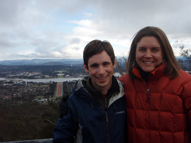
Canberra feels like a capitol -- the architect (Walter Burley Griffin) was an American, and he definitely drew some of his inspiration from Washington D.C. Lots of monuments, lots of museums, lots of streets with funny names in funny configurations, lots of young professionals drawn from other parts of the country to run the government and its attendant structures. However, Canberra blends into its surroundings much better than any capitol city I have ever been to, containing large tracts of open un-manicured space and melting into the hills that surround it (this may have something to do with the fact that Burley Griffin was a student of Frank Lloyd Wright). In fact, Canberra surrounds and is built on several hills, reminiscent of another hilly capitol city.

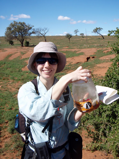
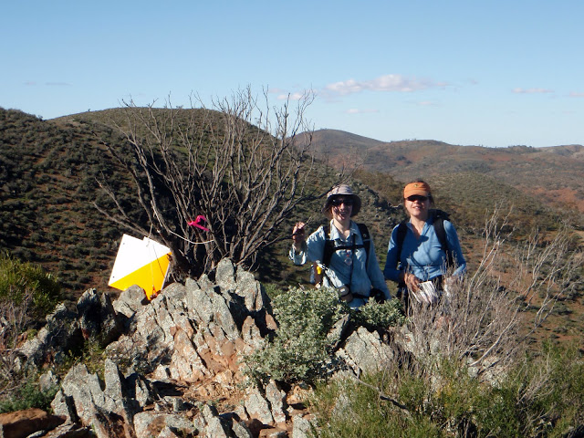
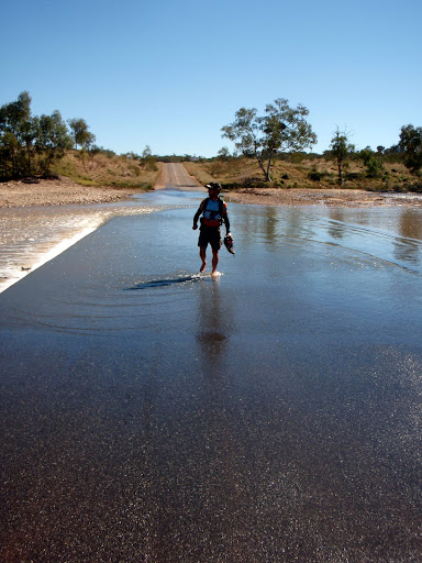
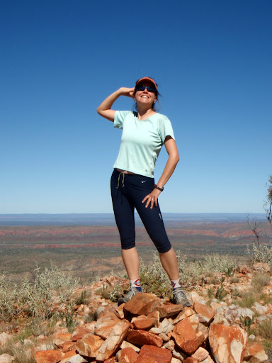
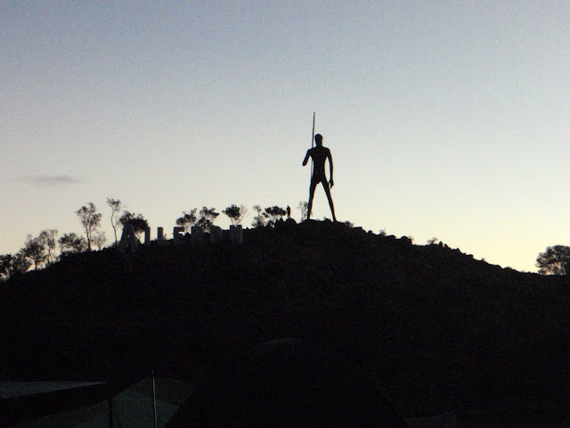
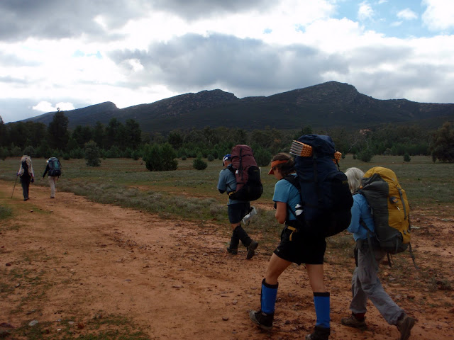
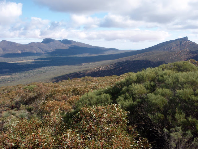
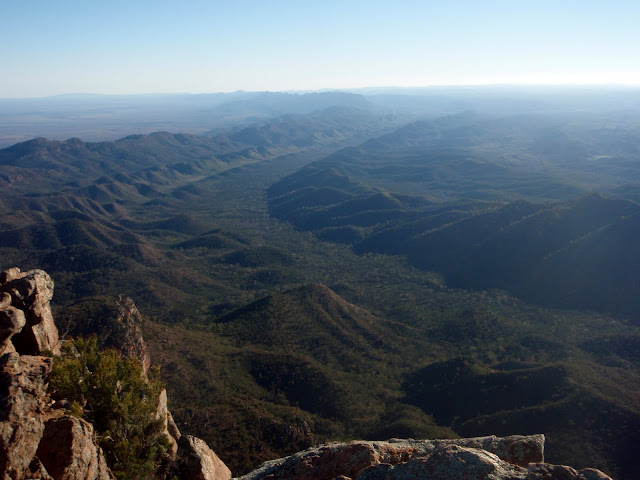
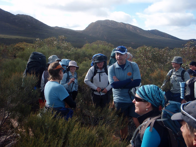
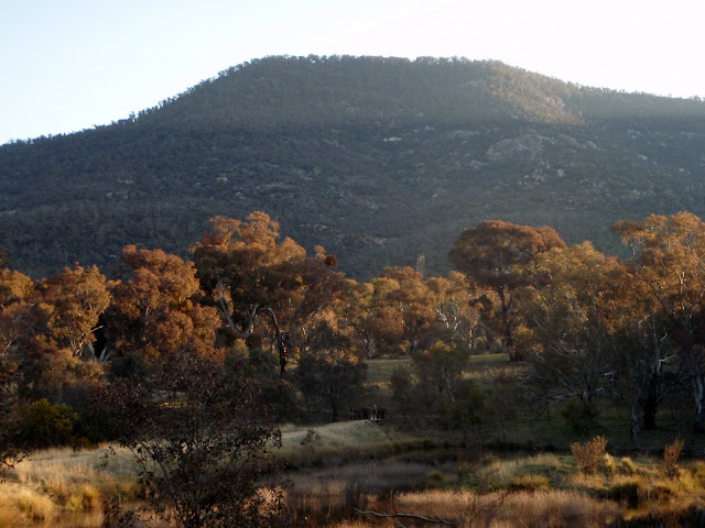
We had a great time at the orientation session, and especially enjoyed getting to meet the other Fulbrighters. We’re particularly excited because Dustin, one of the new scholars, is studying water policy and he and his wife, Heather, are going to be based in Adelaide. Very exciting! In fact, I had the chance to go hiking with Heather up Mt. Tennent in Canberra. It was a beautiful day and a lovely hike.

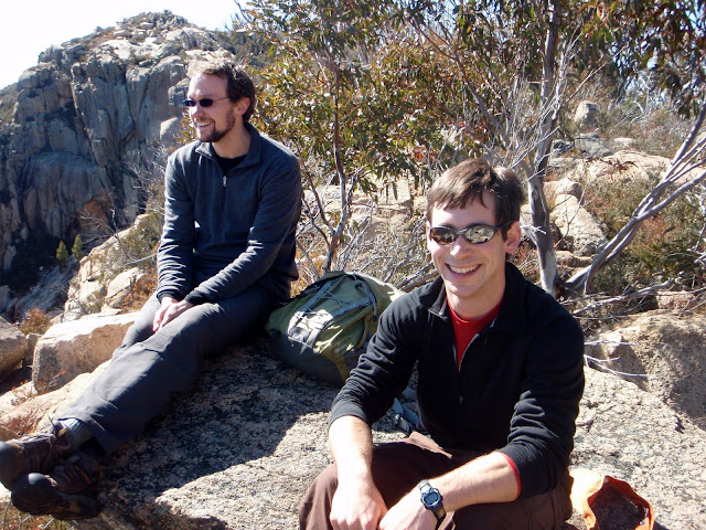
The highlight of our time in Canberra was definitely getting to spend time with Gabe, Dave’s friend from college who is living in Canberra and working for Geoscience Australia. Gabe showed us around Canberra, taking us to Namadgi National Park, the Old Bus Depot markets, the National Library, and Brodburger, a Canberra institution. Brodburger makes and sells gourmet hamburgers from what looks like a gypsy caravan (garish red paint and all) down by the lake. Interestingly, some other businesses are trying to oust Brodburger (or at least to make them move to another less visible location) because they claim that Brodburger is stealing their business, and doesn’t look very nice (read: not sanitized suburbian upper middle class-looking) near the lake. However, all the locals (Canberrans) love Brodburger, and have rallied to save the little trailer-cum-restaurant because they love the food and the convenience. We, too, thoroughly enjoyed our chicken and brie brodburgers, and even signed the petition to help keep Brodburger right where it is!

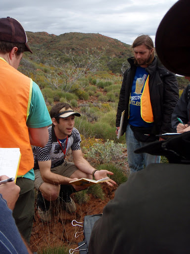
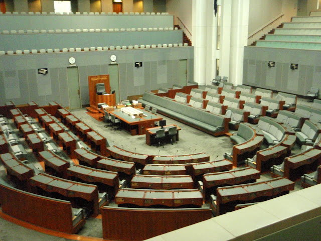
It was certainly an interesting time to be in Canberra. For those of you who aren’t following Australian politics closely, the country still does not have a Government two weeks after the election. Usually, the Fulbright orientation program includes an opportunity to go to Question Time with the Prime Minister. However, since there is no Prime Minister at the moment, we got to have a tour of the Parliament House (which was empty of politicians) and also went to the National Museum of Australia. There we went to an excellent exhibit on the Canning Stock Route, which was an old cattle route in Western Australia. It was not really very successful at all, but we learned about the rather sad history and interactions between Aboriginals and European Australians when the latter were trying to establish the route. Though it wasn’t a particularly pleasant topic, the exhibit is one of the best I’ve seen—highly interactive and engaging and definitely recommended if you happen to be in Canberra. (More pics here.)

Monday, 6 September 2010

Rogaining: Round Two

Perhaps some of you remember the blog about our first 24 hour Rogaine. If you don’t remember it, I certainly do! It’s hard to forget the struggle to keep walking hour after hour in the dark when even the ground seemed like an excellent place to curl up in a ball and take a nap. Ugh, that was a tough one.

Fortunately, our second experience with a 24 hour Rogaine was much different. In fact, I would go so far as to say it was pleasant. Our neighbor, Liz, joined us for the event since her normal partner had some foot issues. We were actually happy to have Liz, a more seasoned Rogainer, with us, because we felt sure that she would keep us to the schedule, and more importantly, keep us from deciding to add on huge extra loops to our plan. And, keep us to the schedule she did.

The Rogaine was in the Bendleby Ranges, which are apparently owned entirely by one land owner. We were talking later with people about what it would take to set up Rogaines in the US, and I think one of the more difficult parts would be finding land owners who are willing to let you use their land. While that’s still a challenge here in Australia, the amazing thing is that often you only need to get the permission of one land owner because people own so much land out in the bush. For instance, this family seemed to own the entire Bendleby Ranges, which seemed to me to be a fairly extensive stretch of hills.

Anyways, the Rogaine went very smoothly for us. The terrain was beautiful, we only got lost once (though it was perhaps at just about the worst time and in the worst place: right before dark and in the trees! Oops!) But, we recovered relatively quickly, and on the whole, did an excellent job of navigating. We even managed to find gummy worms at one control. Also, we made it back to the Hash House at a very reasonable hour (9:30 I think) for some dinner. We enjoyed the dahl that Ryan and Liz had made and frozen a few weeks ago (people volunteer to make up big pots of food ahead of time for the Hash House so that there is plenty of good, warm food for dinner). Dave and I were particularly happy to experience this since we essentially missed out on the Hash House altogether last time. We had a good sleep, and a very comfortable time the next morning when we went out to grab some more controls before the event ended at noon. In fact, I wasn’t really even sore the next day! We probably could have gone a little harder, but we had a great time doing it, felt good during and after, and got a much better sense for how to stay on track.

Other positives included a complete lack of orb spiders, a surprising change of weather overnight (bringing in a wave of much warmer weather), beautiful sun the first day, yummy snacks along the course, and excellent company. The only down side is that when you spend 24 hours of your weekend Rogaining, and another 6 or 7 hours to drive there and back, you suddenly find there are very few hours left in your weekend. But, on the other hand, at least you spend at least 24 hours of your weekend outside in the bush, and that's hard to beat.

Saturday, 4 September 2010

A Beach Vacation in Adelaide

Really, it’s been a blog vacation this past month. Somehow, we still haven’t written about our second week in central Australia, nor anything that’s happened since. Just to get things moving, I think I’ll write about what’s happened since, and then come back later to post about the second week in central Australia. I want to write that one with Dave, and he’s just left this morning on another geology field trip to the Fleurieu Peninsula. It’s raining outside, however, and I am sitting on the couch, having a quiet morning – just perfect for blogging.

Immediately after we returned to Adelaide from central (as we started referring to it), we began house and pet-sitting for some friends who live in Henley Beach. They are from Canada, and were visiting friends and family back there for three weeks. They have one big, energetic black lab named Dawson, and one strange black cat named Jiggs. Living at their house felt like a vacation, and was just what we needed after the intense two weeks in central.

Jiggs would probably be a normal cat if he got to spend some time hunting and roaming outside. But, he is an inside cat, and so finds strange ways to spend his energy. The best game to play with Jiggs was to get in bed, and then move around some part of your body, like your foot, and watch Jiggs pounce on it. It was important to be in bed and protected by the covers, because Jiggs has some pretty sharp claws and can get aggressive. The other excellent game to play with Jiggs was to put Dawson’s leash on, and then walk around the house. Dawson would follow you, with his leash dragging behind. The cat follows behind, attacking the leash as it moves through the house. Who needs to pay for entertainment when you have pets?!

We took Dawson to the beach every single day, and he loved it. I’ve never seen a dog more focused on his ball – or really, on whatever you threw into the ocean for him to fetch. Other dogs would come and chase him, bark at him, try to steal his ball, but for Dawson, it was as if they didn’t exist. For Dawson, there is nothing else besides fetching his ball from the ocean. He never tires, and I mean never. (You can see how eager he is in these photos.) To slow him down and give ourselves a break from throwing the ball every 5 seconds, we sometimes left the ball at home and would throw small rocks into the water. Because the rocks sink, he had a much harder time finding them. But, he was so intent on finding them, that he would often spend several minutes looking around in the surf for the rock. And, amazingly, he sometimes brought back the rock that we had thrown. Other times, he would spend an especially long time digging around in the sand, making strange backward lunges, taking sand with him, and finally unearthing huge rocks. I have no idea how he found these, but it was so funny, and he was so happy. So were we.

Although it was winter, the beach was usually very peaceful, not very cold, and perfect for walks and runs. I love living in the hills, but part of me felt like we should take advantage of the beach while we’re here since I’ve never lived so close to the ocean before. These three weeks were perfect—we got to experience some beach living, getting a sense for the changing tides, spotting dolphins (some very close to shore), and recovering from central Australia.

After three weeks of ball throwing and beach walking, our friends returned home, and so did we. At least to our home away from home – our little granny flat up in the hills. It was actually wonderful to come back. We were happy to see Ryan and Liz again, and to have a cozy spot of our own. Ryan and Liz had us over for a curry dinner to celebrate our recent engagement and to catch up on all of our activities since we left back in mid-June. We got to share our DVD from the Great Barrier Reef, which we love and would be happy to watch with anyone who wants to see it when we’re back in the States.

Things at the granny flat are mostly the same, except for now three chooks are producing eggs, instead of just one. That’s good news for us, since it means we are occasionally the lucky recipients of fresh eggs! And, koalas still make regular visits to the backyard trees, though I recently realized how boring their lives must be. They pretty much sit in the same spot in a tree all day long (and sometimes even longer) eating eucalyptus leaves. Every once in awhile, they switch trees, and in the summer, come down to find water, but that’s about it. Perhaps things will get exciting soon, as I imagine mating season must be coming up. We’ve heard about the deep grunts the males make during mating season, but we haven’t heard these sounds yet. Hopefully that means mating season (and spring!) is on its way. We’ll see.

Tuesday, 3 August 2010

Ormiston Gorge

At this point this is a bit overdue, but here we continue the story of our adventures with Uni Adelaide geology students...

So after a week around Mt. Boothby spent mostly in the rain, we headed for Ormiston Gorge in the western MacDonnell Ranges. After making a stop in Alice Springs to get another week of food supplies and grab some lunch from Bar Doppio's (best cafe in Alice), we drove west, fervently hoping for dry weather. When we arrived at the camping area, we found ourselves setting up in the rain. Ah well.

The next morning, we awoke to find the rain gone. Fantastic -- dry field work is always better than being sopping wet. We immediately forgot about the rain. And it wasn't hard, for the geology at Ormiston is excellent. There are only four map units (including the basement), which allows the students to focus on the structure. The structure at Ormiston is textbook thin-skinned fold-thrust belt stuff -- folds, duplexes, thrust sheets. Except that there is a big thrust fault that puts basement on top of Neoproterozoic sedimentary rocks.


We spent our first day in the field getting the students acquainted with the stratigraphy and looking at the lovely structures. In order to do this, we had to wade across the Ormiston River. No problem. We headed across at about 11 AM and kept doing what we were doing. We didn't think much about it until we were on our way to cross back that we discovered that all of that water that had fallen had made its way downstream and the river had risen considerably. The place that the trail crosses the river was a rushing torrent--certainly not a place I was sending uni students. After some scouting around, we found a wide and relatively shallow (waist-high) part of the river and were able to cross. No problem.


However, the river was running across the road and had risen high enough that the buses could not get out of Ormiston Gorge and back to the campsite. As nightfall approached, we were stuck with eighty wet, hungry uni students and couldn't go anywhere. Solution? Send the intrepid Martin Hand across the river-blocked road and back to camp, where he picked up the moving truck (think a U-Haul) that we had used to ferry gear up from Adelaide. We took groups students across the water, loaded them into the back of the truck illegal-immigrant style, and drove them back to camp at 30 km per hour. We even had dinner at midnight when we finally got the last of the students safely back. All's well that ends well, right?


Happily, there was no more rain and the rest of the week at Ormiston Gorge was sunny and fine. The structural geology was really excellent, and we spent two days walking back and forth over Mt. Ormiston with students near the end of the week. A great way to end a great two weeks of field camp.

Saturday, 31 July 2010

It never rains in central Australia…

Famous last words. Shortly after returning from diving and rainforesting up in northern Queensland, we were off on a new adventure: taking the third-year geology students at Uni Adelaide to central Australia for two weeks of mapping. Central Australia is known for its warm days, cold nights, and excellent Proterozoic (2500-542 Ma) rocks.


There are a few things about taking the geology students to central Australia. Number one, they haven’t done any mapping since they went to Pichi Richi as second-year students, which for them was over a year ago (actually, they map regolith in between there, but that doesn’t really count). Number two, most of the students (with a few notable exceptions) aren’t very well prepared for being in the out-of-doors. Number three, there are 80 or so of them. That complicates things.

To move eighty students to a location more than 1500 km from Adelaide requires two coaches. This is great, because the coaches each have two drivers and they don’t have to stop. But the coaches don’t really have room for the tents, food, cooking gear, and beer that the students bring. This means that we (the obliging staff) drive cargo vehicles. And we have to stop, so we leave a full day and a half before the coaches. Chelsea and I thought that while driving slowly for 1500 km might be a bit tiring, it might be better than trying to sleep on a coach with 40 noisy, sweaty students. So on Saturday morning our convoy of two cargo vans and a 16-foot moving truck (is that a four-meter moving truck here?) headed north for Alice Springs.


After the obligatory stop in Port Wakefield, the drive was really quite lovely. It’s been wetter this year than it has for the previous ten in the eastern half of Australia, and the landscape is unusually green. This also means that kangaroos can find water out in the bush rather than coming to the road (where moisture collects) and jumping in front of cars. Our rented cargo vehicles all lacked roo bars, so this was a good thing. And we never had to drive for too long, because the moving van could only go about 250 or 300 km on a tank of petrol, so we stopped frequently. Driving on the Stuart Highway, which goes from Port Augusta to Darwin, is a pretty simple affair. There is a station every 150-250 km, so in a normal car with a 500 km range, you stop at every other station for petrol (except in our case, where we stopped at nearly every station). The road is so straight that if you need to pass, you just wait until there are no cars, which is nearly all the time.

We stopped for the night in Coober Pedy, the world center of opal mining, before pressing on to Alice Springs the next day. Alice Springs had everything we needed: grocery stores to buy the food we needed to feed the 15 teaching staff for two weeks, wireless internet, and a fabulous café. It also had rain. Who thought I would be digging to the bottom of our bag for my rain pants in Alice Springs? The following morning, we food-shopped, bought ponchos for unprepared students, and met the buses to drive ~130 km north to Aileron, the next station up the Stuart Highway.


Like most of the stations along the highway, Aileron serves up petrol, food, beer, tourist souvenirs, and other necessities of life—in many ways it is the local market and meeting place. Aileron’s name has nothing to do with the flaps on an airplane; my guess is that it is a corruption of Alyuen, a local community of indigenous Anmatjere people. However, Aileron seems to have attempted to make amends for this by erecting a giant (>10m tall) statue of a male Anmatjere hunter on a hill behind the station. At some point, someone thought that some gender equity should be established, so there is a separate sculpture of an Anmatjere woman and child next to the station as well.


Most importantly for us, Aileron has a caravan park and is just a few kilometers from the mapping area. And when we arrived to set up camp, it was raining. We let the students stay in camp rather than mapping in the rain in jeans, but the staff headed off to look at some sapphrine-bearing rocks (sapphrine is a mineral considered indicative of ultra-high temperature metamorphism). The following day the rain had decreased, and by late morning we were out in the field with the students. It’s a little intimidating to be thrown into leading a group of students through rocks that you have never seen before and have next to no background in, but then you remember that you know more than they do about mapping and metamorphic rocks.


The rocks around Aileron are high-grade metamorphic rocks—granulites, often migmatitic—which means that they have experienced temperatures greater than 700-800°C and some parts of them have begun to melt. Those kinds of pressures and temperatures are found kilometers down in the crust, so the rocks at Aileron have really interesting metamorphic minerals that you don’t get to see at Earth’s surface very often—minerals like cordierite and sillimanite. Remarkably, original details of the rocks are still preserved despite this intense metamorphism—individual packages of migmatitic gneiss progress from very aluminous to barely aluminous, probably turbidites with decreasing clay toward the top (yes, they are somehow still nearly right-side-up). Chilled margins on mafic dikes are still clearly visible, although they have been metamorphosed as well. In a number of locations, shear zones (wet ones which often have kyanite growing in them and dry ones that have become mylonites) cut through these high-grade rocks. And to top it off, this area has experienced a fair number of metamorphic episodes (some people estimate as many as 15) between the deposition/formation of the original rocks and the exhumation of the metamorphosed rocks during the Devonian and Carboniferous (about 350 Ma). This makes it fun to work out the different episodes of deformation.

Kyanite growing in a hydrated shear zone

But enough geo-babble. After the rain went away, it turned suddenly to T-shirt weather and the mapping was great. The food we were cooking in the evening was also great—we made things like chicken laksa, pasta fagiole, and baked potatoes in the campfire. For dessert we had crepes and beer-enhanced damper. It was very satisfying to sit around the campfire with a contented stomach and talk with friends at the end of the day. Well, not quite the end of the day—Martin, the leader of the trip, usually did a brief lecture about local geology and mapping pointers in the evening. But soon after it was off to our tent for a long (and relatively warm) night of sleep before getting up early to set out breakfast and do it all over again.


Folded mylonite-grade shear zone

Before we knew it, the students were finishing up their maps and we packed the vans up to head to Alice Springs for a re-supply and then drive to Ormiston Gorge for our second week of mapping…

(More photos from the first week are posted here.)

Tuesday, 20 July 2010

June 24th, 2010

The day went something like this.

We woke up early at our Noah Beach campsite, and went for a walk on the beach to see the sunrise. We headed in one direction, but when we saw a sign warning that there had been a recent crocodile sighting, we headed the other way. There were a few clouds on the horizon, so we waited to see the sun rise over the clouds. We shared the beach with an older gentleman out walking and a man playing cricket with his three young boys.

After the sun came up, we headed back to pack up camp. It was still well before 9am (the time the local café opened for breakfast), so we drove down the road a bit to a boardwalk through the mangroves in the Daintree Rainforest. We were the only ones there, and enjoyed the quiet peacefulness of the morning forest.

We finished, and still it wasn’t 9am, so Dave suggested we head down to Cow Bay. We had been there the day before, and found the beach to be absolutely beautiful. There were these amazing patterns made of sand balls all over the beach. They appear to be made by little crabs which excavate little holes, making little balls of sand which they push out of their holes. The patterns the crabs made with the balls of sand were reminiscent of a certain style of Aboriginal artwork which contains lots of little dots. There were also interesting rocks at Cow Bay, with neat little chitons, which got Dave very excited. Indeed, we liked the beach at Cow Bay more than any of the others we had stopped at the day before, so I was happy to make another visit that morning.

We were standing there on the beach, and I must have been standing up on a rock, or on somewhat higher ground, because I was feeling especially tall compared to Dave. I said to him, “I’m soooo big (as in so tall).” And he said, “But not as big as the ocean.” Then I said, “And you’re so small (short).” And he said, “But not as small as these crabs.” “But,” he said, “I can move sideways like they do.” And he proceeded to scuttle sideways across the beach. Very romantic, indeed.

Well, at least Dave must have been feeling romantic, because the next thing I knew, he was asking me to marry him, and pulling a ring out of his pocket. I was completely surprised, not because he was asking, but because I couldn’t believe he had a ring. I assumed he hadn’t really gotten himself organized before we left the US, but in fact, he had prepared everything, and even asked my parents for permission back in December before we left.

When I finally told my parents, I think they were so relieved because they’d had to be quiet about it for nearly 6 months! My Mom told me how hard it had been to keep it quiet, and my Dad told me that he figured Dave had changed his mind since it had been so long! I think Dave’s mom was thinking the same thing as well.

But, I suppose Dave was just waiting for the right time. Cow Bay is lovely – in fact, Lonely Planet describes it like this: “ Cow Bay is simply beautiful.” It was just the two of us on the beach, at least at first. After I had said yes and we’d hugged a few times, a guy walked out onto the beach and gave us a wave. The next thing we knew, he’d taken off all of his clothes and was going for a swim. Not exactly what I expected to see immediately after getting engaged, but there you go!

Dave told me that he’d spoken with the crabs, and if it hadn’t been high tide, they had agreed to write out, “Will you marry me?” with their sand balls. I told him that was OK, and that I was glad he hadn’t decided to propose to me while we were scuba diving under water. While it would have been a good story, I had visions of getting overly excited and losing my regulator. Plus, how would I have said, “Yes!” underwater? Giving the thumb’s up means let’s go up, hugging with scuba tanks on would have been awkward, and what if Dave had dropped the ring down there?! Indeed, I was glad to be on terra firma, even if there was a naked man just behind us!

We celebrated the rest of the day by walking through the rainforest and seeing two cassowaries named Fred and Wilma (these dinosaur-looking birds are often tricky to find), eating four flavors of ice cream at the Daintree Ice Cream shop (they only make four flavors each day, and your only choice is to buy a cup with a scoop of each), eating Thai food for dinner (where we learned from our menu about vegerarianism, which we assume must be some new religion), and finishing off the day with homemade gelato.

So, that’s the story. We have not picked a date yet, but we’ll let you know when we do! For now, it’s off to central Australia for two weeks in the bush looking for rocks. I can’t wait (seriously) : )

And, here's the very excellent photo we took of ourselves just after getting engaged!

Friday, 2 July 2010

What did you do for the Queen's Birthday?

In South Australia, the Queen's birthday is the second Monday in June (for some reason, it is celebrated at the end of September in Western Australia). For us, it was a long weekend and a chance to get out of town and into the out-of-doors. We grabbed some dinner from the Central Market, walked over to the bus station, loaded our backpacks, got on the bus with 40 other people from the Adelaide Bushwalking Club, and headed to the central Flinders Ranges. We arrived at the Wilpena caravan park around 1 AM, quickly set up camp, and went to bed. The next morning, we broke into groups, and headed out for the weekend to go backpacking.


Wilpena Pound is an interesting geologic feature that sort of looks like an elongated saucer. As Dave explains it, after the sedimentary rocks had been deposited essentially flat, they were squished in one direction, reshaping the rocks into parallel folds. The Pound was a syncline, which means that the rocks on either side slant down toward the middle in an arch. Later deformation pushed up the ends of the Pound to make this unusual bathtub-like shape. Early European settlers called it a ‘pound’ because it was a handy place to keep livestock. All they had to do was close off the one entrance, and there’s really no way for an animal like a horse to get out.


There were several walk choices for the long weekend, so Dave and I decided that we would do a walk which included having a base camp in the middle of Wilpena Pound. This trip allowed us to climb two peaks, and also to explore the Edeowie Gorge, which seemed to us to be many of the highlights of the Pound. Also, we thought it might be a good idea to limit the amount of time we spent carrying full packs since we only have our trail runners with us, and not sturdy hiking boots. When you go bushwalking, you usually have to carry all of your water because there really aren’t any reliable streams in the desert. That meant our packs were heavier than normal, so we thought it would be nice not to spend the entire weekend with full packs on our backs.

Of course, a number of other people also thought that this trip sounded like a good idea, so we had a fairly large group. At first, we were thinking that it would sort of spoil our weekend in the wilderness. But, we decided that it was silly to let something like that ruin our time there, so instead, we decided we’d enjoy ourselves no matter what happened with the group. And, indeed, we did. We met Liz and Steve, a wonderful couple from Oregon. (Liz is originally Australian, but she had lived in Oregon for the last three decades). They had recently moved (or moved back) to Australia to learn a little bit about Liz’s own country. We really enjoyed talking and walking with them.


The other people were good value as well, mostly because they provided a lot of entertainment. I know that sounds really bad, but let me explain. One woman (I think this may have been one of her first bushwalks ever) had recently purchased a dehydrator and a vacuum sealer. She had spent the entire week before the bushwalk dehydrating and vacuum sealing all of her food. And, I mean ALL of her food. The first day, she pulled out a sealed bag filled with shredded carrots and lettuce. Then, for dinner the first night, she had a steak and a dehydrated baked potato. (For some reason, she had separated the inside of the potato from the skin.) It was the first and probably will be the only time I meet someone who brings a streak backpacking! At lunch the next day, she pulled out her sealed potato chips (why she felt the need to vacuum pack potato chips, I will never know.) It was really hilarious. And, I can’t imagine how much plastic waste she must have been carrying with her by the end of the trip.


Another couple (who were probably also fairly new to backpacking) would use their stove at lunch time to make things like soup and macaroni and cheese. Another woman didn’t bring a stove at all, but instead ate tomatoes, avocadoes and dehydrated bread for the whole trip.
It felt a little bit strange to be riding on a coach up to the Flinders to go backpacking (bushwalking, as they call it here). It was also a bit strange, because we were definitely the only people on the bus under 30.

After exploring around the Pound for a couple days, we woke up in the dark at 5:30 on the last morning to climb St. Mary Peak, the highest peak in the Flinders (at a whopping 1171 m). St. Mary Peak is actually not a long or dangerous walk, but we needed to be back to catch the bus by 11 AM, so we were off walking in the cold and dark. As we climbed upwards, the sun peaked over the top of the far wall of the Pound. After a quick jaunt to the peak for amazing views in every direction and a soaring wedge-tailed eagle for company, we meandered down through the trees to the waiting bus. On the way back to Adelaide we reflected—a regrettably quick trip to one of the classic spots (probably the classic spot) in the Flinders, but it had been beautiful and relaxing, with some hilarious spectacle to boot.